El Niño 2026: A Rapid Development
The rapid development of El Niño in 2026 is expected to significantly alter weather patterns across the globe. This phenomenon is gaining strength faster than initially predicted, with implications that could affect millions.
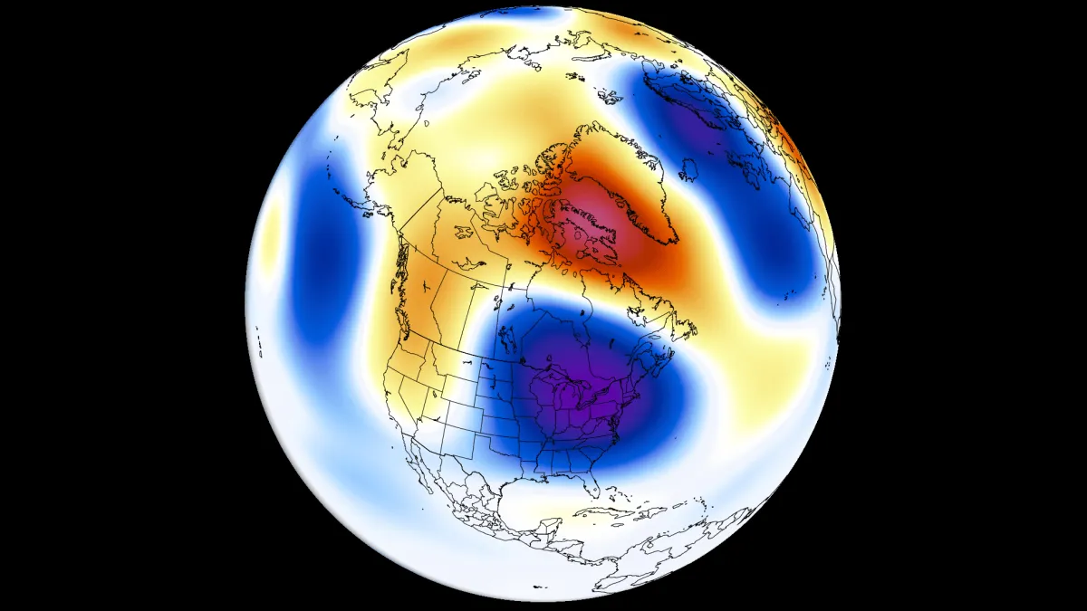
A powerful oceanic Kelvin wave has intensified, marking the end of a multi-year La Niña influence. As these changes unfold, meteorologists are observing shifts in the El Niño-Southern Oscillation (ENSO) cycle, which alternates between warm and cold phases every 1-3 years.
Key forecasts for Summer 2026:
- The latest ECMWF and UKMO models indicate a stronger El Niño signature in pressure patterns than earlier updates.
- There is a high probability that a Super El Niño will develop by the second half of 2026.
- A low-pressure area is expected over eastern Canada and the northeastern United States.
- Above-normal temperatures are forecast for the northwestern United States and western Canada.
- In contrast, less precipitation is anticipated over the far southern United States and across southern and central Canada.
More rainfall is forecast for the western, central, and northeastern United States as well as parts of southeastern Canada. This shift in precipitation could lead to significant agricultural impacts, particularly in regions that have faced drought conditions in recent years.
Officials have not yet confirmed how these changes will impact specific regions or industries. However, the ongoing developments suggest a need for preparedness as communities brace for potential disruptions.
Callum Henderson is an Edinburgh-based reporter for News UK covering politics and national affairs across the United Kingdom.
Related Posts

Mars: Elon Musk’s $80 Billion Plan for Colonization
UK Weather Forecast: Significant Drop in Temperatures